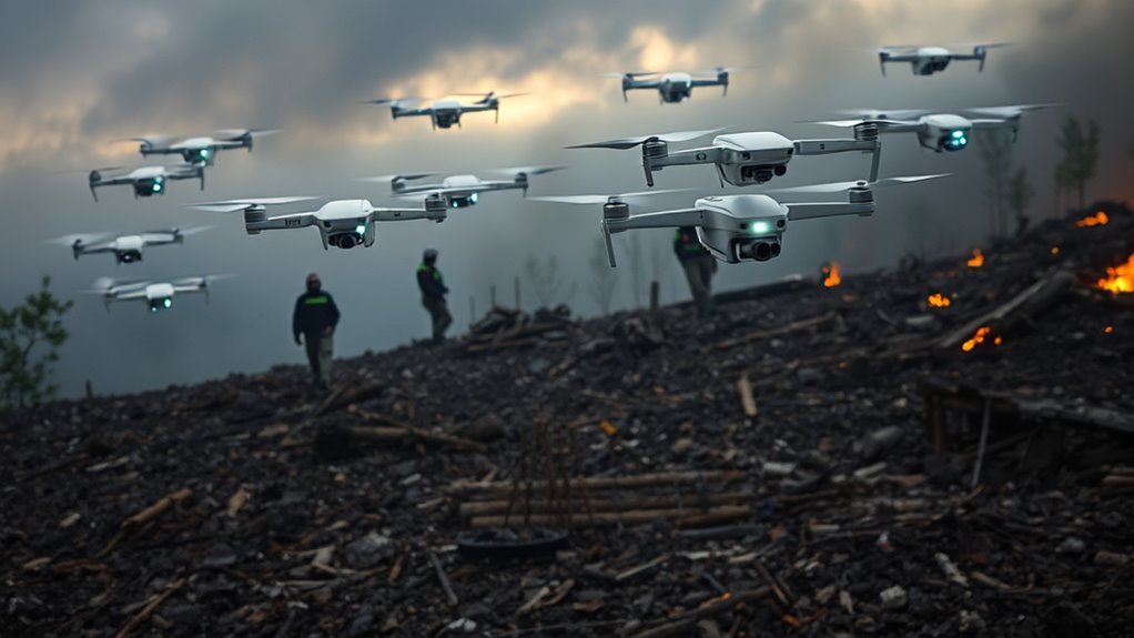

Autonomous drones are changing disaster relief by quickly surveying affected areas and gathering critical data. They can create real-time maps of debris, infrastructure, and terrain, helping you plan relief efforts more effectively. With AI navigation, these drones avoid obstacles and operate safely even in GPS-denied zones, reducing risks for rescue teams. Their ability to deliver supplies and assess damage makes response faster and safer. Keep exploring to understand how these innovations save lives and improve crisis management.
Key Takeaways
- Autonomous drones provide rapid, real-time mapping and data collection to assess disaster zones efficiently.
- AI navigation enables safe, obstacle-avoiding flight paths in complex, GPS-denied environments.
- They facilitate faster aid delivery and resource allocation, reducing response times significantly.
- Drones operate independently, minimizing risks to rescue teams during hazardous missions.
- Enhanced situational awareness improves decision-making and supports effective disaster management efforts.
Autonomous drones are transforming disaster relief operations by providing rapid, precise assistance in crisis zones. When a disaster strikes, every second counts, and these drones can quickly survey affected areas, gather critical data, and deliver aid efficiently. They leverage advanced mapping technology, which allows them to create detailed, real-time maps of the terrain, debris, and affected infrastructure. This capability guarantees relief teams have accurate information to plan their response and avoid dangerous zones. The integration of AI navigation further enhances their effectiveness. With AI-powered algorithms, drones can autonomously chart safe flight paths, avoid obstacles, and adapt to changing environments without human intervention. This means they can operate in complex, unpredictable disaster zones where manual navigation would be risky or impossible.
Autonomous drones revolutionize disaster relief with real-time mapping and AI navigation, enabling safer, faster, and more precise aid delivery.
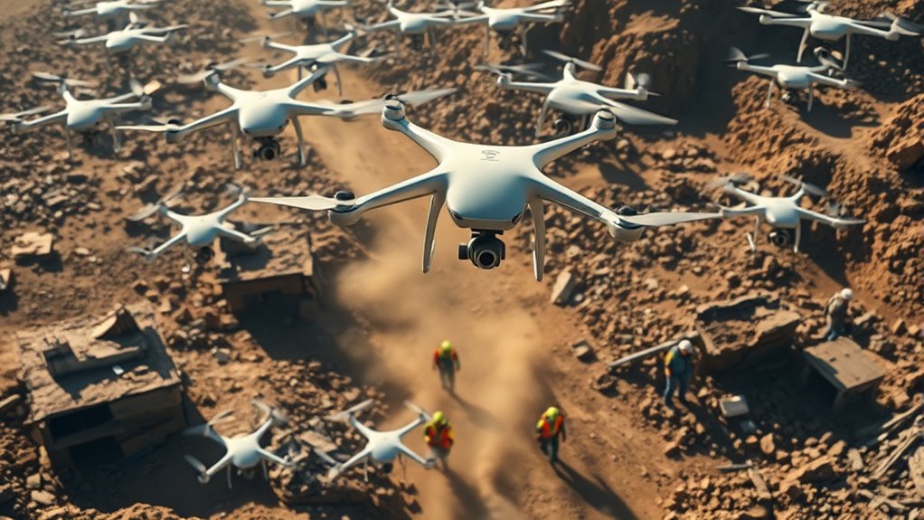
As you deploy these drones, you’ll notice how their mapping technology gives you an all-encompassing view of the disaster landscape. They can fly over collapsed buildings, flooded areas, or wildfire zones, collecting high-resolution imagery and sensor data. This data is transmitted back instantly, enabling rescue teams to assess damage, locate survivors, and prioritize resource allocation. The AI navigation systems process this information on the fly, allowing the drones to maneuver through narrow spaces or dense debris fields with precision. This reduces the need for risky ground searches and accelerates the overall response time. Additionally, because these drones operate autonomously, you don’t need to constantly monitor their flight paths—they can perform their tasks independently, freeing up personnel to focus on direct rescue efforts.
You’ll also find that their ability to operate in GPS-denied environments is a game-changer. In disaster zones where infrastructure is damaged or signals are disrupted, AI navigation allows drones to rely on onboard sensors and real-time mapping technology to navigate accurately. This guarantees continuous operation, even when traditional navigation systems fail. An important technology enabling this capability is advanced onboard sensors that support navigation without GPS. The combination of advanced mapping and AI-powered navigation not only boosts efficiency but also enhances safety for rescue teams by reducing the need for risky manual reconnaissance. Moreover, these drones can be programmed to deliver supplies like medical kits or communication devices to stranded individuals, reaching places that are otherwise inaccessible.
In essence, the synergy between mapping technology and AI navigation equips autonomous drones with the intelligence and agility needed to respond swiftly and safely during disasters. As you incorporate these tools into your relief efforts, you’ll see how they revolutionize the way aid is delivered, making disaster response more effective, safer, and faster. Their ability to operate independently, adapt to dynamic environments, and provide detailed situational awareness transforms your approach to crisis management, ultimately saving more lives and mitigating damage more efficiently.
Frequently Asked Questions
How Do Drones Navigate Complex Disaster Environments Autonomously?
You might wonder how drones navigate complex environments on their own. They use sensor fusion to combine data from cameras, LIDAR, and GPS, creating a detailed understanding of their surroundings. Machine learning algorithms help interpret this data, allowing the drone to recognize obstacles and adapt to changing conditions. This combination enables autonomous drones to maneuver safely through disaster zones, making them effective tools for search and rescue missions.
What Are the Limitations of Drone Battery Life in Relief Missions?
Battery life limits how long your drone can operate, especially in demanding situations. Battery constraints mean you often need to manage power carefully, balancing flight time with mission tasks. Effective power management becomes essential to extend operational periods, but you’re still limited by battery capacity. You might consider swapping batteries or using energy-efficient components, yet these solutions only partially mitigate the challenge of maintaining prolonged, autonomous drone activity during relief efforts.
How Is Data Security Maintained During Drone Operations?
Imagine your data is a treasure chest; you wouldn’t leave it unguarded. During drone operations, you maintain data security with encryption protocols that scramble information, making it unreadable to outsiders. Access controls act like keys, ensuring only authorized personnel can open sensitive data. These measures protect essential information, just like a locked treasure chest, safeguarding mission success and individual privacy in critical relief efforts.
Can Autonomous Drones Operate in Extreme Weather Conditions?
You might wonder if autonomous drones can handle extreme weather conditions. With advanced sensor technology and weather resilience features, they’re increasingly capable of operating in challenging environments. These drones are designed to adapt to high winds, rain, or snow, ensuring mission continuity. Developers focus on enhancing weather resilience, so you can rely on them for critical tasks even when conditions are tough, making disaster relief efforts more effective and timely.
What Regulations Govern Drone Use in Disaster Zones?
Think of regulations as the invisible safety net guiding drone use in disaster zones. You need to follow legal frameworks set by national authorities and adhere to international treaties that ensure responsible operations. These rules cover airspace permissions, privacy concerns, and safety standards. By respecting these guidelines, you help prevent chaos and guarantee drones contribute effectively, safely, and ethically to relief efforts across different regions.
Conclusion
You see how autonomous drones transform disaster relief, speeding up damage assessments, delivering supplies, and saving lives. You witness their ability to reach inaccessible areas, operate tirelessly, and provide real-time data. You recognize their potential to improve coordination, reduce risks, and increase efficiency. You understand that embracing this technology means embracing hope, innovation, and resilience. You realize that, with autonomous drones, you can make a difference—turning disaster response into a faster, safer, and more effective mission.